
Discover New Water Resources in Just Weeks
VMF technology is a powerful tool for discovering geothermal and groundwater supplies at significant depths. Beyond mapping aquifers in sedimentary, crystalline rocks, and superficial deposits, our system also accurately determines the chemical composition of groundwater. Additionally, it can detect pollution plumes within groundwater systems, providing comprehensive insights into water quality and resource availability.
Stages of Research Using the VMF Methodology
Area Selection and Preliminary Study
The initial stage involves selecting the target research area and conducting a preliminary geological study based on relevant data and criteria.
Acquisition of High-Resolution Satellite Data
High-quality, high-resolution satellite imagery is obtained to ensure the most accurate representation of the area for analysis.
Processing of Digital Data
Advanced processing techniques are applied to the satellite data, including spinor and multispectral analysis, along with specialized mathematical models and programming to extract key information about the area.
Development of 2D Models
A two-dimensional model is created to map the surface projection of the concentrations of targeted elements. This stage focuses on the identification of ore deposits based on genetically related elements, such as Au, Ag, Cu, Fe, S, N, C, and others.
Creation of 3D Volumetric Models
A three-dimensional model is developed to visualize the distribution and concentration of selected elements within specific geological blocks. This volumetric model is built by processing data from both frontal and angular geological surveys, incorporating depth-related signal correlation coefficients.
PAST PROJECT SAMPLE
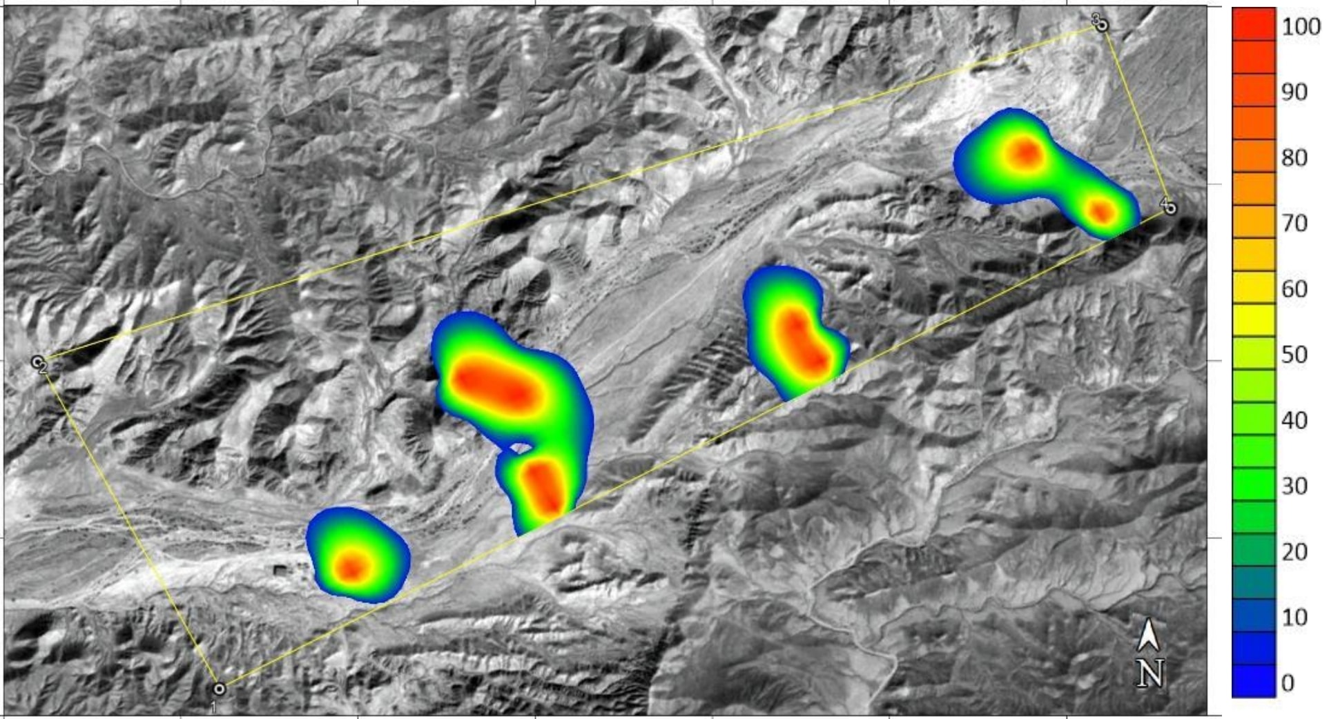
Creation of a 2D Model for Water Bodies
The research was conducted using VMF Technology (Verification Multispectral Forecast), which is based on advanced mathematical and multispectral image analysis of the Earth's surface in the study area. Through a phased multispectral and specialized mathematical analysis of the intensity of electromagnetic fields, data were gathered on the localization of accumulations of Hydrogen (H), Deuterium (D), and Oxygen (O) in the region under investigation.
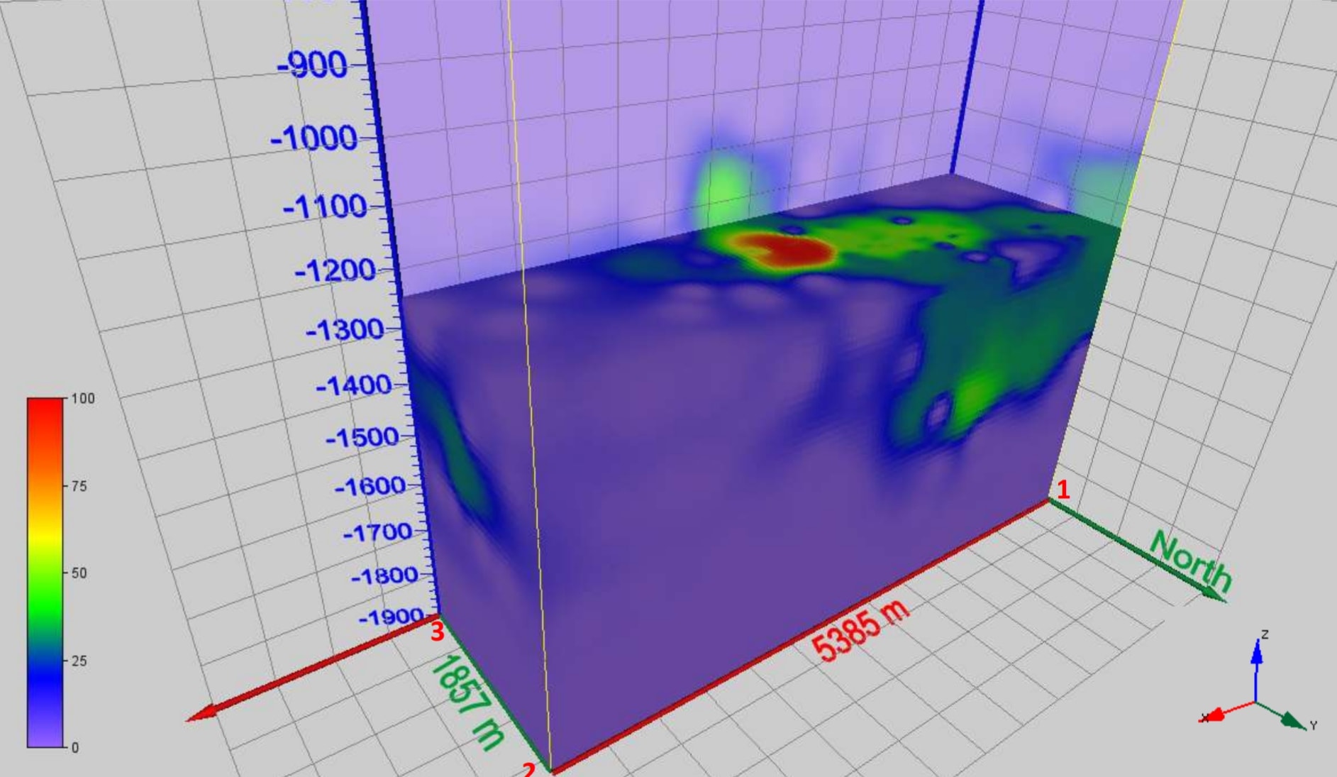
Creation of a 3D Block Model for Water Bodies
The objective of this phase is to construct a deep geological 3D model of the field, extending to a depth of 1,300 meters, and to assess the estimated water resources within this area. The model will provide a detailed representation of the subsurface water distribution, enabling accurate estimation of available water reserves and supporting efficient resource management.
VMF Capabilities: Groundwater Volume Calculation
Contact our team to discuss your groundwater survey requirements.
Get in Touch